
Maps & Tracks
Maps and tracks and other features of the park
(Google Maps) park location - situated between the Wellington suburbs of Ngaio, Crofton Downs, Wadestown and Kaiwharawhara.
Click on one of the maps below to view on-line or to download as a PDF.
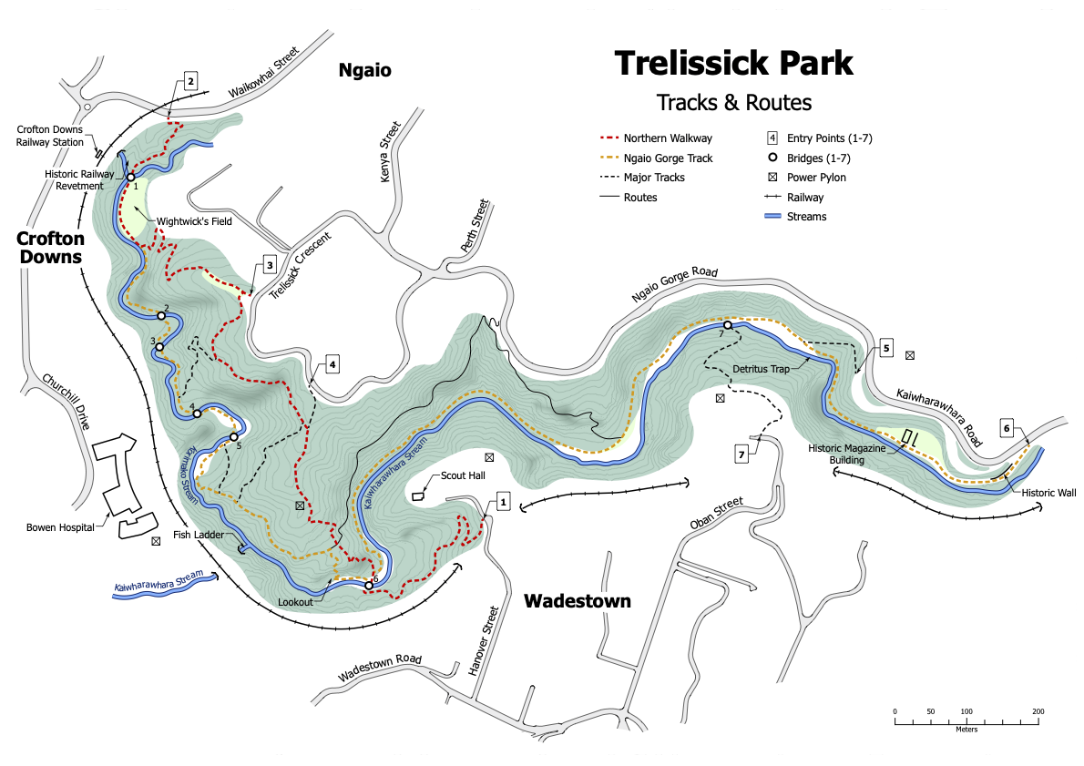
Ungridded map
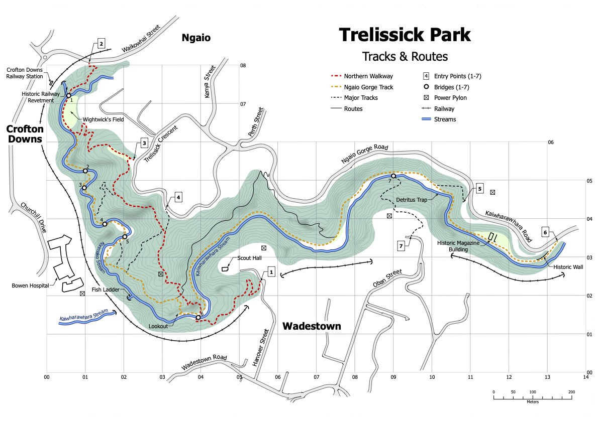
Gridded map
Tracks of Trelissick Park
There are only two named tracks through the Park shown on the above maps. However, there are numbers of other tracks and routes in the Park - all worthy of exploring. The below link provides more specific information on the various options.
Entrances to Trelissick Park
As an elongated urban Park, Trelissick Park has entrances from several nearby suburbs: Ngaio, Crofton Downs, Wadestown and Kaiwharawhara. There are seven major entrances numbered from 1 to 7, shown on the above maps as "entry points".
Bridges of Trelissick Park
Trelissick Park has seven bridge crossings of the two major streams in Trelissick Park. The bridges are numbered from 1 to 7 going downstream and are shown on the above maps. There have been a number of major changes over the years, but currently five of the bridges are in the Korimako Stream valley and two of the bridges are in the Kaiwharawhara Stream valley.
Memorials within Trelissick Park
Trelissick Park has a number of planted trees, benches and a track in memory of volunteers and others.
Features of Trelissick Park
Excluding tracks, entrances, bridges, memorials - there are a number of major 'features' shown on the maps of Trelissick Park.

Trelissick Park Group
Page last updated: 27 March 2024